It is, and with a lot of difference, the route with more tradition and one of the most beautiful and with more stories to tell.
The philology tells us that the blue puddle takes its name from the term of Arabic Arab origin, which indicates the presence of a small dam in the area, used to irrigate the garden adjacent to the town. If we look closely we can still observe some remains of ditches that start right from this point.
The road is very easy to travel and is quite well signposted so it is not easy to get lost. There are two possible roads one that would start in the southern part of the town, which is the most recommended for those who do not want to walk much, since they can park nearby (down the river) and save the climb back. This road is born from a road that is passing the municipal pool and before reaching the cemetery. We will meet in the lower part of the town known as Barranquilla. We can continue forward and go down almost to the level of the river, the ideal place to park our vehicle near the sewage treatment plant. Once there, we have to follow the path to our right. The other path goes down the north face of the town towards the river and we can take it along a street near the town square. It is perfectly indicated its route through the streets of the town and then there is no loss, always down and upstream. We can also ask the locals who will kindly answer us.
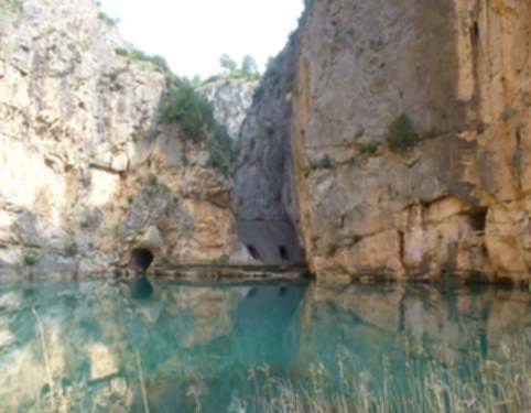
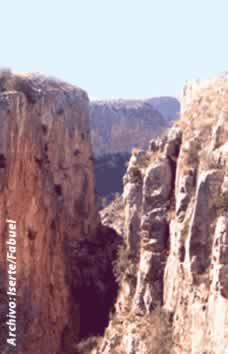
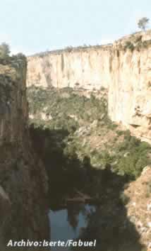 As we get closer we will check how the canyon through which the river flows until it reaches the blue puddle, where the walls are only 10 meters away. In the early and mid-twentieth century, an incipient hydroelectric industry was developed in the area that has recently been re-incentivized (new plant in the Loriguilla reservoir). We see that from the blue puddle there is a channel for the use of this hydroelectric power that dumps its waters about 5 km downstream.
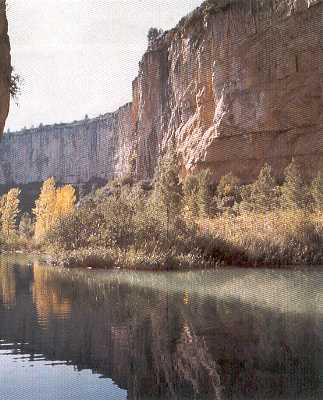 The stories are many of this part of the town, the best known are about the old form of transport used by the waters of the river to carry wood from the northern mountains to the city of Valencia. Due to the narrowness, small agglomerations of logs were formed that had to be undone, a rather complicated task and in which many men lost their lives, so a small hermitage was built on the left side of the river, beyond the Calderones. There are also stories of drowning, when the river was free and there were no dams to contain it. At present there is a tremendous neglect on the part of the local authorities that have lost the walkway that led to the azud, destroyed after the flood of 1989. Although after a long time the access to the blue puddle has improved, it seems unlikely the connection from here by walkway to the Calderones. The only possibility is to go swimming. A journey not without danger.
 Finally I will tell you that the time it takes to arrive is a little less than half an hour and to return from something else, which is all up.