An Exceptional Viewpoint in the Heart of Turia
In the province of Valencia, at the beginning of the Valencian Serranía region, the imposing Muela de Chulilla rises, a rock formation that dominates the landscape of the Turia river canyon on its south side. On its north side, you can even see some mountains of Teruel and Castellón. This destination, not overcrowded but of great beauty, is ideal for hikers and anthropology lovers looking for routes with spectacular views, technical challenges, a deep connection with nature, and to discover old, disused constructions.
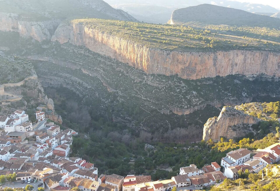
The ascent to the Muela of Chulilla not only offers a demanding but short route, but also a unique visual reward: panoramic views of the encased meanders of the Turia, the vertical walls of the canyon, the towns of the region, and especially seeing how the town shrinks as we ascend. In this article, we will detail the route, its difficulties, points of interest, and tips to fully enjoy this experience.
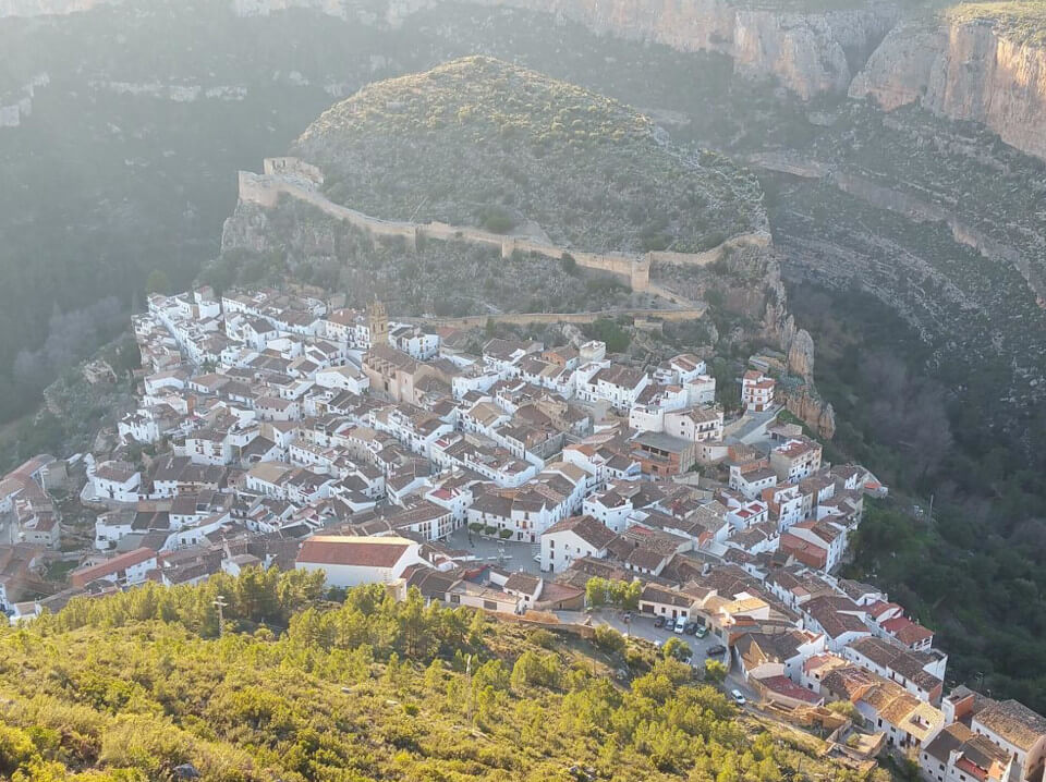
Panoramic view from the top of the Muela de Chulilla
Route Technical Data
- Distance: 6.5 KM (circular)
- Positive Elevation Gain: 309 m
- Duration: 2-3 hours (depending on pace)
- Difficulty: Medium (only the initial climb requires some physical fitness, but not much)
- Recommended Season: Autumn, winter, and spring (avoid summer due to heat, but it is a route also done in summer; some people even climb up to sleep and watch the sunrise facing east)
- Starting Point: Chulilla Town Hall Square or the Eras parking lot.
How to Get to Chulilla
Chulilla is located 50 km from Valencia, accessible via CV-35 towards L’Eliana and Liria. From there, take CV-394 until you reach the town. There is free parking on the outskirts, although in high season it is advisable to arrive early. Here is more detailed information on how to get to Chulilla
Route Description
1. Start: Chulilla and the Camino de la fuente del Lebrillico
The route begins in the main square of Chulilla, a town with steep streets and whitewashed houses that retains a medieval charm. From the Town Hall Square, we follow the signs towards the Eras parking lot, where we will find a path that ascends towards the Muela.
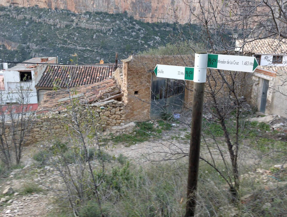
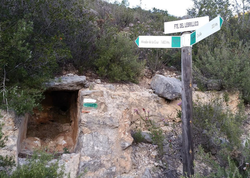
This first section is the toughest and most complicated. As soon as you go up to the Eras parking lot, look for the start of the trail markings. We will have noticed the avalanche protection fences that were placed a few years ago and save the town if there is a rock fall. The path runs through pine trees in an area of terraces with crops abandoned since the late 19th century with the arrival of phylloxera. As we ascend, we can also find some strawberry trees and lentisks, with views of the canyon. We will follow the beginning of the path along the canalization of the Lebrillico spring, which was made in the 70s. I have never seen that spring with water; I suppose it is only seen when there is good rain.
Before climbing, there is an area of high humidity; here we will notice the vigor of the plants and a higher proportion of strawberry trees. Once at the top, we will walk along the precipice and take photos of these unbeatable views.
2. Up on the Muela
The first steps we take will be to visit the cross, a true natural viewpoint not suitable for people with vertigo.
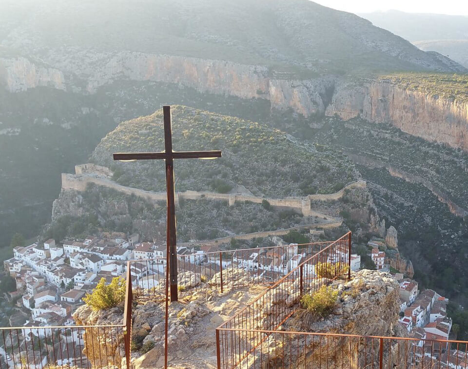
We can take a tour of the small hill where the cross stands and see all the points of the contornà.
3. Through the Muela
Up on the muela there are several places to go:
- Resers: these are constructions with three walls designed to shelter from the cierzo (northwest wind that blows cold in winter). There are several on the Muela plateau. There are no direct paths. It’s a bit like finding Wally. They are near old cultivation areas.
- Stone constructions: there are several igloo-shaped constructions that are filled inside with stones. I don’t know their meaning or origin.
- Geodetic vertex: located north of the Muela. It is the highest point. The towns of Losa del Obispo and Villar del Arzobispo are clearly visible.
- Viewpoint to the east: if we get up early and on clear days, a small blue strip is seen on the horizon. It is the Mediterranean Sea. To access this viewpoint, follow the forest road and turn northeast at the sharp uphill curve. A few years ago, from this point, people paraglided and flew over the entire area.
4. Descent via the Forest Track
For the return, we opt for a forest track that descends in zigzag towards Chulilla. It is much less technical than the ascent, but equally picturesque, with constant panoramic views of the valley. There is another option to go down and up by a path that leaves this track and goes up a narrow path to the left to reach the cross of the Muela. It is a much shorter route. It is also more slippery. We continue down, and upon reaching the town, it is ideal to regain strength in one of its bars, where they serve typical dishes such as olla de berzas or Valencian paella.
Recommendations and Equipment
- Footwear: Trekking boots with good support (the terrain is rocky and slippery in some sections).
- Water: Minimum 1 liter per person (there are no fountains on the route).
- Sun protection: Hat, glasses, and cream (there are sections without shade).
- Map/GPS: Although the trail is marked, having a map or app like Wikiloc or Orux maps always helps.
- Poles: Useful for the ascent and descent by path.
Other Activities in the Area
If you have extra time, Chulilla and its surroundings offer more options:
The climb to the Muela de Chulilla is one of the most rewarding routes in Chulilla, combining nature, history, and physical challenge. It is suitable for all types of public, although the ascent section, unless done by the forest track, can tire those less initiated in hiking.
If you are looking for a climb with stunning views, this is your destination. And if after the walk you want to relax, nothing better than a swim in the Charco Azul or a beer on a Chulilla terrace.
Do you dare to conquer the Muela? ♂️⛰️
Have you done this route? Leave your experience in the comments!
GPX Track: Download the GPS track
© 2025 chulilla.net. All rights reserved.